
Distance: 2km
Time: 2 hours – Actually, it could be considerably shorter. About 15 minutes of that was sitting around after finishing and there was a lot of heat-induced heel-dragging.
Difficulty: 2.5/10 – It’s short and no challenge for anyone who’s done any similar walking but there were plenty of not regular hikers who seemed to be finding it tough.
Total ascent: 245m
Water: 0.6L – On a hot summer day we quickly drank everything we’d brought and then wanted more, you probably wouldn’t need much in the winter though.
Shade: Dappled – a lot of the path is under trees but I still needed an umbrella.
Mobile network: No problem
Enjoyment: 5.5/10 – The city sunset views are the best part of this hike, but perhaps if the waterfall is in full flow it would be a little more exciting.
Map:

Link to a GPX file available here.
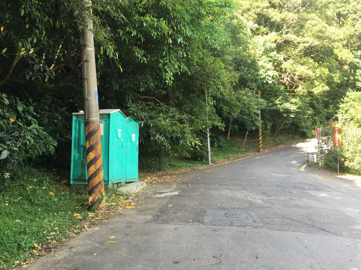
Head up the road from the car park, (if you need the loo there are some slightly nicer temple toilets nearby so you can give the portaloos a miss.
At the elbow of the road two paths lead into the greenery. The lower path takes you to Xiufeng Falls (秀峰瀑布), the upper path goes directly* to Dajian Shan (大尖山). We wanted to see the falls so we took the lower one on the right.
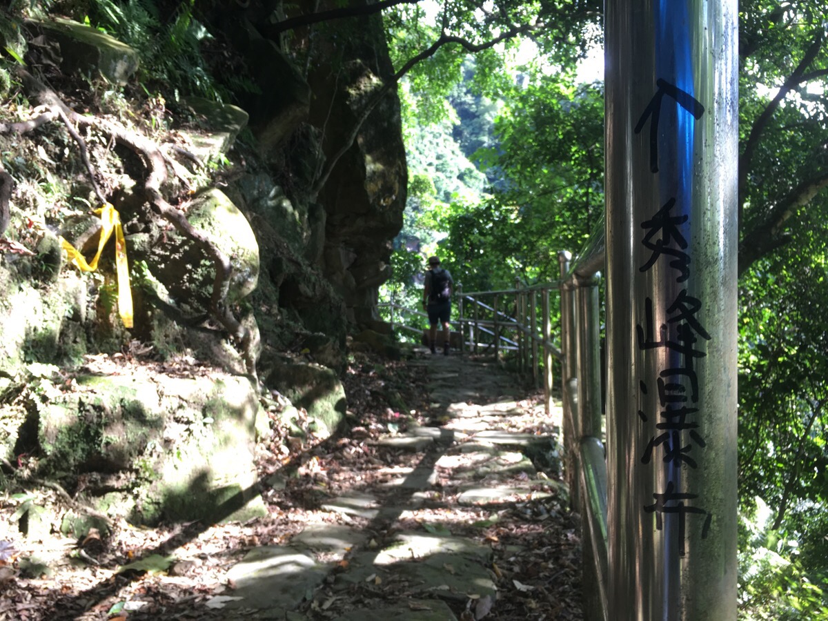
The path skirts a rock face and at one point you can squeeze through a narrow channel in the rocks if you wish to.
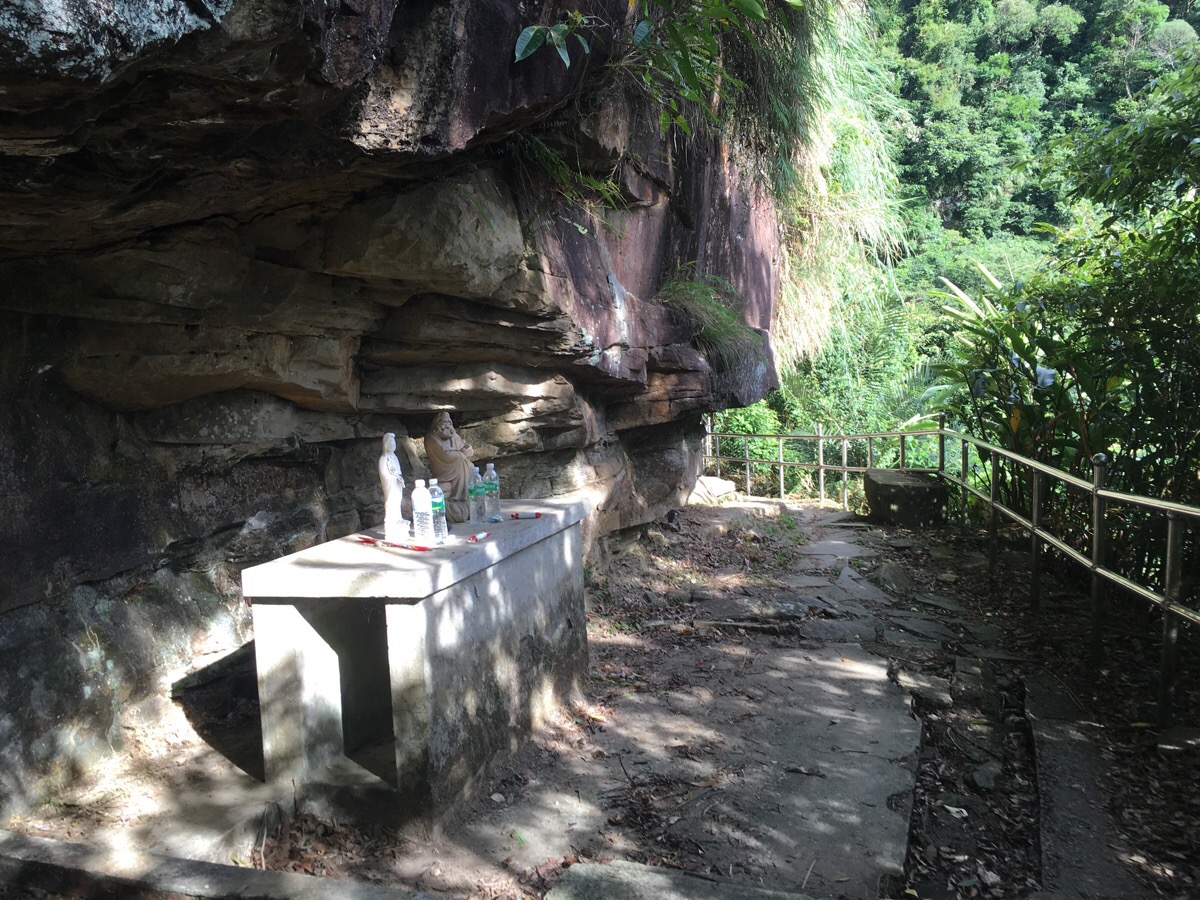
Just around the corner from the falls is a small shrine with a couple of picnics benches.
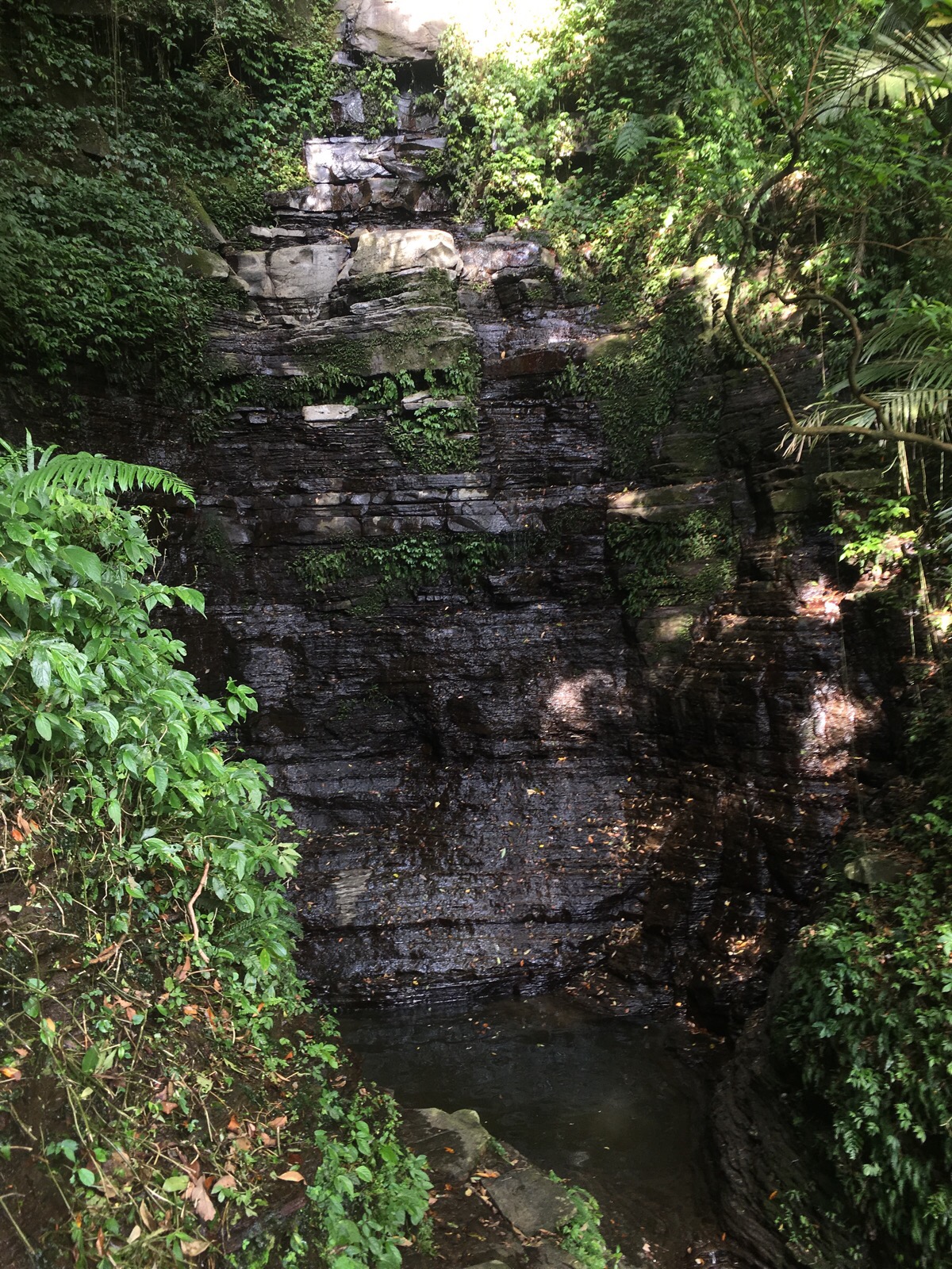
We visited in the height of summer after a few dry days, so there wasn’t much of a waterfall to see. However the bowl carved out by centuries of falling water was rather impressive – standing next to the pool where a small channel lets the water escape, your voice echos back to you like it would in an empty church, it’s really rather lovely. A group of youngsters had set up a barbecue at the nearby picnic table and since the path heading down to the next fall had been blocked, we turned around and retraced our steps. There’s information on the full trail here, but I’m not sure when it was written.

Part way back to the road the path splits, the junction is unsignposted. Left goes back to the road so we chose to go right towards Dajian shan.

*After a short way the path merges with the direct Dajian shan path running from the road. If you look left here you can see the road. We headed right and started the climb.

When the route hits the road we continued right until the path came up the to road.
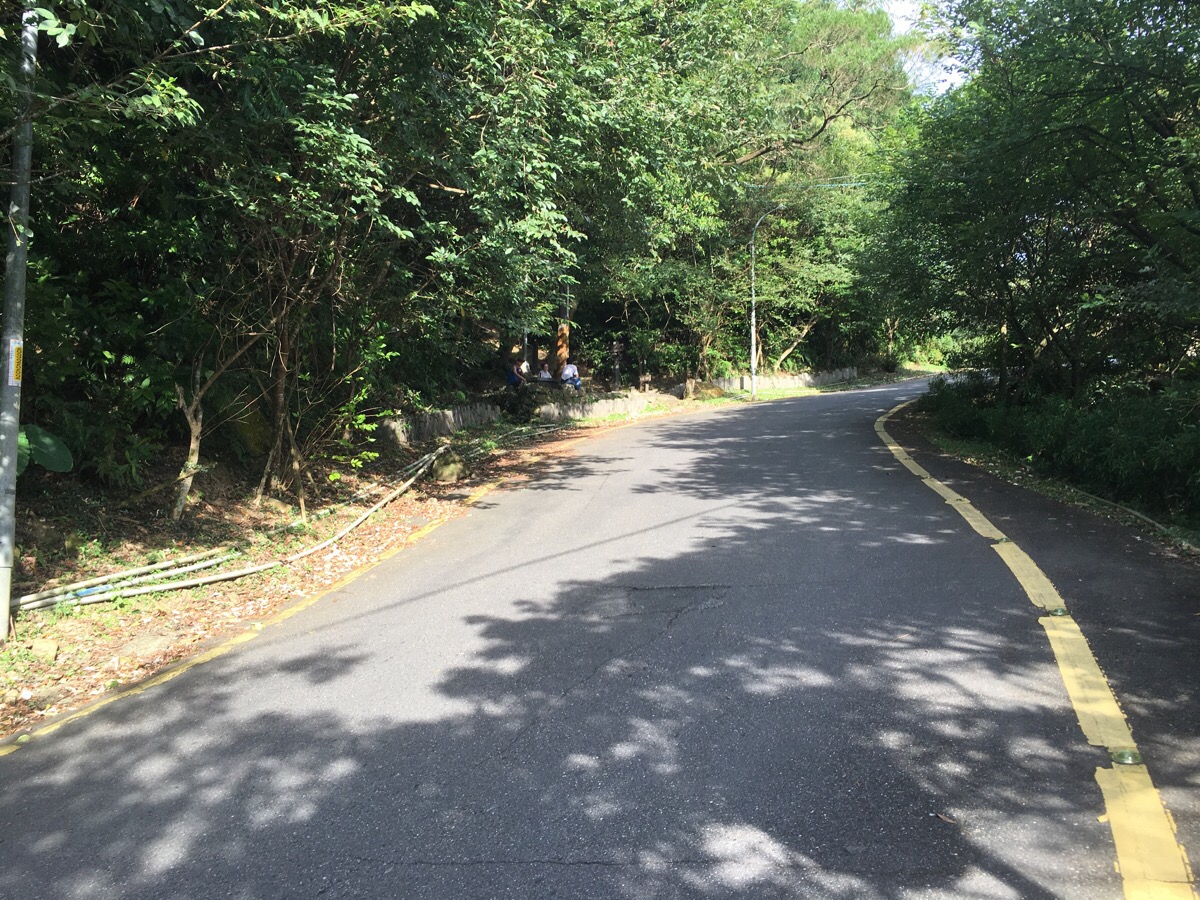
Crossing over the road and going uphill you’ll arrive at the entrance to the next part of the trail. A sign says that it’s 0.35km to the top of Dajian Shan.

As you near the top there are signs indicating a longer walk to Sifenwei mountain but we decided to save that for another day.
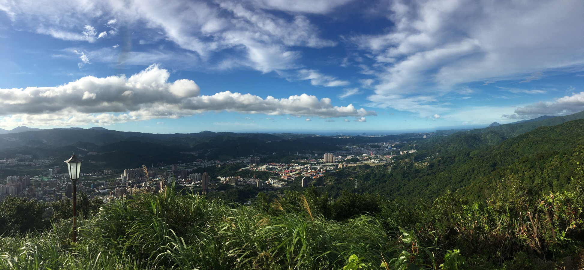
From the lookout pavillion on the top we were treated to wonderfully clear views stretching all the way out to Keelung in the west – that sharp peak on the right of the picture is Keelung mountain. Looking towards the east gave views of Taipei city with 101 standing out in the crowd as it does. There were quite a few people hanging out here and getting in the way of an Instagram couple who were trying to get self portraits from all angles.

After catching our breath we followed the path down towards 勤進路 (Qin Jin Road).
The sun was lowering towards the horizon as we descended so we got lots of beautiful light.

The path comes down into the forecourt of Tianxiu Temple (天秀宮). To get back to the car park from here you can either follow the road left or walk up towards the toilets and down the steps from there.
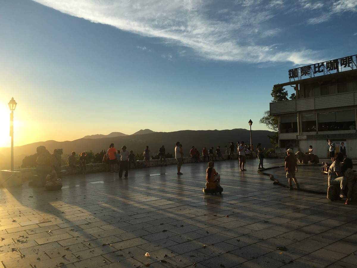
We stopped and sat on the wall for a while to watch the sun set, it’s obviously a popular spot for sunset photography as there were banks of photographers lined up along the edge of the road with tripods and sensible clothing. We didn’t wait to see the sun dip below the horizon (we went off in search of hotpot instead), but by the time we left, the whole area was flooded with cinematic orange light.
how to get there
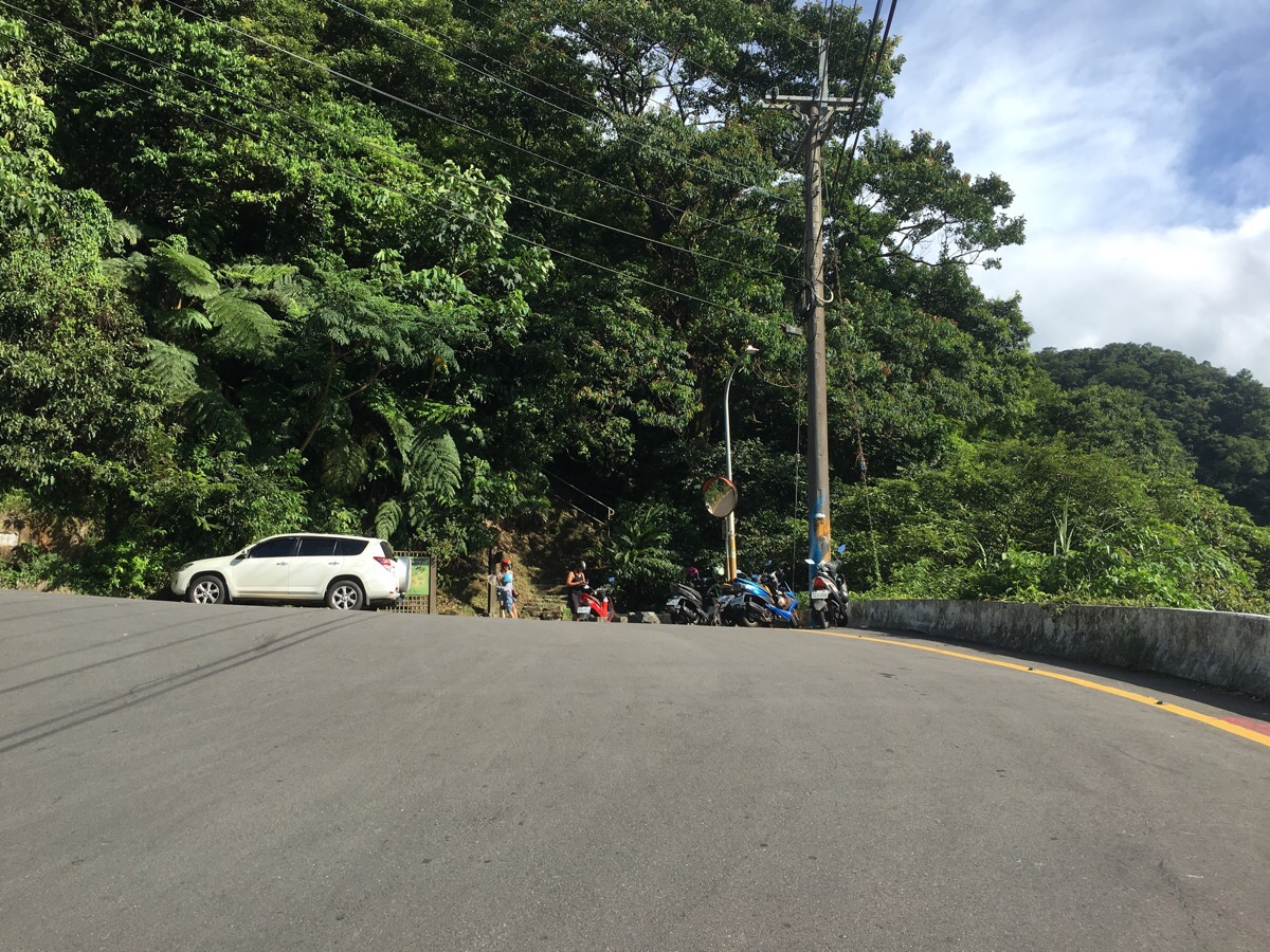
google maps address: Qin Jinlu Parking, 221, New Taipei City, Xizhi District – plenty of parking spaces and picnic tables with elephant and camel statues.
GPS location: N25 03.112 E121 39.825
public transport: there is a bus from Xizhi bus station, the F911, but it only goes once an hour – walking from the train station would add 2.2 uphill kilometres to the walk.
My new words learnt on this walk were:
- 天啊 / tiān a / oh God!
- 駱駝 / luòtuó / camel

I’m enjoying your blog a lot, but I’m mystified by the tiny amounts of water you drink on these excursions. You should seriously push yourself to carry more and drink more because dehydration is no joke!
LikeLiked by 1 person
I’m glad your enjoying the walks. I promise I’m drinking enough! The water figures are for one person only and are generally a little over what was actually consumed. I guess the one thing that isn’t taken into account is that we’ve always got extra in the car or scooter for when we finish. (I’m a bit obsessed myself about staying hydrated when walking.)
Having said that, I think I’ve got two preparation methods depending on the type of hiking it is. For casual strolls (as this one is), I don’t stress about it and decide once there what to pack since I’ve usual got more than I need to take in the car – especially since in Taiwan many of walks like this take in a temple or two where they usually have water (although I wouldn’t ever plan a walk around an assumed water source). But when it’s the longer or more strenuous hikes then it’s a totally different game. We’ve got hydration packs now with 3L and 2L capacities, before that we’d have similar volumes in bottles which wasn’t ideal. The other thing we’ve got in our kit for overnight trips is a portable water filtration kit, unfortunately all our attempts to do longer trips have so far been thwarted by crappy weather!
LikeLike
Good to hear. As you know a lot of hiking routes are on dry ridges, so overheating especially in the hotter months is something to avoid. For longer hikes I boil water or use iodine drops. Unless it’s coming directly out of the rock, consider all water as suspect. There’s quite a lot of wildlife such as barking deer etc even quite near inhabited areas.
LikeLiked by 1 person
For sure. We’ve got one of the sawyer water systems and/or the option of boiling depending on where we’re going or what we’re doing, (but as I said, unfortunately not much chance to put it to the test out there yet). Are you also Taiwan based? And if so, do you have any recommendations for us? I don’t have nearly as much opportunity as I would like to for actually getting out and up the mountains but I’d love to hear about your favourites.
LikeLike
I tend to concentrate on secondary trails in northern Taiwan these days, so a bit hit and miss as far as quality goes, but if you want to to do an overnight camping trip with peak views, you could try TangSueiShan which is in Taoyuan County. The trailhead starts just beyond Galahe village. You have the option of parking your car and setting up camp in the field there and then going up and back to the peak in one day. Beautiful view of TaoShan and DaBaJienShan from the peak. There are some easier peaks near GuGuan that can be combined into camping overnight pre or post hike, but these are better done in the cooler months because it’s uncomfortable to camp at low elevations in the summer. I don’t use commercial campsites, preferring to camp guerrilla style off-trail and I use public transport, so I don’t need to return to the same place like I would if using a car. That might be different from what you do!
LikeLiked by 1 person
I’ve got my eye on a few near GuGuan if I ever have enough time (and good weather) to get back there. The TangSueiShan one sounds good too. Thank you very much for the recommendations!
LikeLike